Client Case
PUR Projet
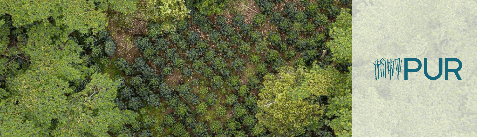
Integrating Remote Sensing into Nature-Based Solutions: A Pilot with PUR
CASE STUDY
PUR Projet is a certified B Corp, global leader in Nature-Based Solutions and the original Insetting organization. PUR Projet works with over 150 companies across 40 countries to regenerate ecosystems while empowering local communities to operate long-term socio-environmental projects including agroforestry, land preservation and sustainable agricultural practices.
Over the past years, PUR Project has developed an ever-increasing soil & vegetation CO2 sequestration offer, serving large corporate worldwide willing to fulfill their carbon-reduction commitments.
Industry
Agro-forestry
Clients
Large Corporations WW using raw material and/or willing to offset their C02
Location
France, Worldwide
How to improve the reliability of the ground measurements by adding a verification layer?
The reliability of the VCM has often been questioned. From overestimations of CO2 to failed projects, many have been the instances where trust in the VCM was shaken. Therefore, increasing the accuracy of carbon estimations and improving monitoring practices was, at the time, one of PUR’s strategic priorities to continue supplying verifiable high-quality carbon credits.
How to increase the coverage of the project monitoring?
Increasing the coverage of project monitoring allows for better data, better reports and verifiable carbon credits.
How to increase the frequency of measurements to avoid not meeting captured carbon projections?
Carrying out a full biomass inventory with remote sensing becomes less time-consuming and requires less field trips. This means that the frequency of measurements can be increased and malpractices, such as early harvesting, can be flagged early on. This contributes to meeting the goals of carbon estimations and making sure that the projected scenarios come to fruition.
How to feed adaptive management and improve field practices?
Alongside the technological innovation, PUR invested in training sessions for it’s collaborators across their sites to maximise the efficiency and benefits of introducing remote sensing, drones and updated geolocation equipment into their monitoring operations. This also required adaptive management practices, to adequately adapt the operations to the new procedures, guaranteeing high-quality results.
No off-the-shelf solutions to tackle agroforestry with small parcels in tropical climates
During the early stages of the project it was clear that to satisfy PUR’s needs, multiple service providers would be needed: equipment providers, data scientists, remote sensing specialists, among others. Additionally, many of PUR’s parcels are located in tropical climates that are difficult to access. The deployment of drones was therefore conditioned not only by climate conditions, but also terrain.
An off-the shelf solution was not available and extensive market research was done to work with the most appropriate methodologies and professionals. The efficient management of the project was crucial during these early stages to ensure that the multiple parts worked together efficiently. The companies that helped fulfil this project included Skylab, Globhe, Linn Aerospace and Airbus.
Listing of the use cases that would bring added value to PUR
Remote Sensing has multiple applications in Nature-based solutions, namely:
- With low definition satellite imagery:
- Deforestation alerts
- Baseline measurements
- With high to very high definition satellite imagery:
- Natural events detection
- Tree permanence
Benchmarking of drones vs satellites to adapt images based on specific needs
Drones and satellites provide different resolution of images and can capture different information. The suitability of either one or the other depends on the goals and the local context.
Step by step approach to start create value with easier use cases, such as the detection of tree permanence
A tailored approach to the introduction of remote sensing, with a 3-phased project:
- Biomass estimation model with low-res satellite imagery
- Tree height model with drone imagery
- Hi-res biomass estimation model, deriving from drone and satellite data
In each step we were able to assess the opportunities, challenges and value added. This enables the creation of a tailored and adaptative strategy on remote sensing integration.
50 Ha monitored with satellite imagery
10 use cases tested
2 projects industrialized