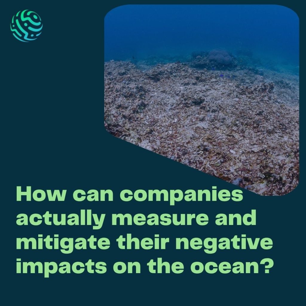
Ocean acidification is one of the most direct consequences of rising CO2 emissions, but it rarely exists in isolation. Overfishing, offshore infrastructure, shipping traffic, and pollution all interact with a changing ocean chemistry, making it difficult for companies to isolate, or even measure, their specific impact on marine ecosystems.
For companies, this creates a fundamental challenge: How do you measure an impact in an environment that is vast, dynamic, difficult to access and constantly changing?
Unlike many land-based operations, much of the ocean cannot be directly observed from the surface. Historically, this has made it difficult for companies with offshore or marine-dependent operations to move beyond broad commitments towards measurable, location-specific and verifiable action.
That is beginning to change, as a new generation of technologies is making the ocean increasingly observable, from the DNA organisms leave behind to satellites tracking vessels across millions of square kilometres, to autonomous sensors measuring ocean chemistry continuously.
But no single technology can capture the full picture, the future of ocean impact measurement lies in combining different technologies to answer different questions.
1. Detect biodiversity: eDNA & bioacoustics
Companies need to understand the ecosystems they operate in by first identifying which species are present.
🧬 Environmental DNA
Every organism sheds genetic material into its surroundings through skin cells, mucus, waste and other biological material. By collecting and analysing water samples, environmental DNA (eDNA) can identify species present in an area without physically capturing or disturbing them.
This is particularly relevant for offshore developments, where traditional biodiversity surveys can be invasive, expensive and difficult to conduct around infrastructure.
NatureMetrics, a specialist eDNA provider, has worked with EDF Renewables and Natural Power at the Blyth Offshore Demonstrator in the North Sea, comparing eDNA sampling against traditional trawl surveys and finding it a viable, less invasive, and often more cost-effective alternative. Similar programs – including the WinDNA project in Denmark and Fugro’s BeWild initiative – are extending this approach across other offshore wind sites in Europe.
The technology is now being explored across offshore wind, marine conservation, aquaculture and other marine environments.
🔊 Bioacoustics
DNA is not the only biological signal we can measure. Hydrophones and acoustic monitoring systems can record the sounds produced by marine organisms, as well as anthropogenic noise from ships, construction and offshore infrastructure. This can help monitor marine mammal presence, species activity and changes in underwater soundscapes. It can also measure a pressure that is often overlooked in corporate environmental assessments: underwater noise.
The IMO identifies underwater radiated noise from ships as an environmental pressure and has developed guidelines for measuring and reducing it.
Together, eDNA and bioacoustics offer complementary ways to monitor biodiversity:
DNA tells us what is present. Sound can tell us what is active and what pressures are being introduced.
2. Observe human activity: satellites, AIS & AI
Companies and regulators also need to understand what is happening in the ecosystem. This is where satellite remote sensing, vessel tracking and artificial intelligence become powerful. Satellite imagery can monitor changes in coastal habitats, water quality, sediment plumes, algal blooms and infrastructure over large geographic areas.
Meanwhile, vessel-tracking systems combine technologies such as AIS (Automatic Identification Systems), satellite imagery and machine learning to reconstruct activity at sea.
Global Fishing Watch is a leading example. Its platform combines vessel tracking and other satellite data to identify fishing activity and other maritime activity, while its 2026 IUU Fishing Risk Insights dataset uses behavioural indicators such as vessels switching off positional broadcasts, interacting with other vessels and obscuring their identity to help identify potential IUU fishing risks.
Instead of relying solely on internal records or supplier declarations, organisations can increasingly use independent geospatial evidence to understand what is happening across their marine value chain.
For shipping, fisheries, offshore energy and other marine-dependent sectors, this can help identify:
- activity within sensitive ecosystems;
- interactions with marine protected areas;
- potential IUU fishing;
- vessel activity and routing;
- offshore infrastructure;
- changes in coastal habitats.
And AI is increasingly important here, not as a replacement for environmental science, but as a way to process the enormous quantities of imagery and tracking data that humans cannot analyse manually.
3. Measure ocean conditions: sensors, autonomous vehicles & underwater robotics
Knowing what species are present and what activities are occurring is only part of the picture.
We also need to know what is happening to the physical and chemical environment?
This is particularly important for ocean acidification. Ocean acidification cannot be captured by measuring pH alone. Monitoring the carbonate system can involve pH, partial pressure of CO₂ (pCO₂), dissolved inorganic carbon (DIC) and total alkalinity, alongside temperature, salinity and dissolved oxygen. NOAA identifies these as key parameters for understanding changing ocean chemistry.
🌊 Autonomous observing systems
Traditionally, collecting this information required research vessels or fixed monitoring stations. Increasingly, autonomous platforms are extending the reach of ocean observation:
- Argo and Biogeochemical-Argo floats
- Saildrone and other autonomous surface vehicles
- AUVs — Autonomous Underwater Vehicles
- ROVs — Remotely Operated Vehicles
- Moored buoys and sensor arrays
These platforms can measure conditions across areas and depths that would otherwise be difficult or expensive to monitor. NOAA’s Biogeochemical-Argo systems, for example, can measure variables including oxygen, nitrate, chlorophyll-a, pH and suspended particles, in addition to temperature, salinity and pressure.
For companies operating around ports, offshore installations, aquaculture sites or other marine infrastructure, these technologies can provide continuous, site-specific environmental baselines rather than occasional snapshots.
🔊 Sonar & underwater imaging
Some of the most important information is also hidden from conventional observation. Multibeam sonar, hydroacoustic systems, underwater cameras and imaging technologies can map the seabed, characterise habitats, identify marine organisms and monitor changes around underwater infrastructure.
ROVs and AUVs can bring these technologies into environments that are difficult or dangerous for human divers to access, from offshore wind foundations to deep-sea environments.
Increasingly, computer vision and machine learning can then automate the analysis of underwater imagery, helping identify species, classify habitats and detect changes over time.
The result is another layer of evidence: what is happening on and around the seabed?
5. Connect the data: from measurements to an ocean footprint
The real breakthrough, however, is not any single sensor or platform. It is the ability to combine them.
In an offshore wind development eDNA can provide information about biodiversity, acoustic monitoring can identify marine mammals and underwater noise, satellite data can provide spatial context, AIS data can reveal vessel activity, autonomous sensors can measure temperature, oxygen and carbonate chemistry, sonar and underwater imaging can characterise habitats and seabed conditions.
Individually, each dataset answers a different question, but together they can begin to tell the story of how an activity interacts with its surrounding ecosystem. This is where geospatial data platforms, cloud infrastructure, AI and interoperable datasets become increasingly important.
6. From environmental data to corporate decisions
The final step is translating measurements into something companies can actually use.
This is where frameworks such as the Taskforce on Nature-related Financial Disclosures (TNFD) become important. TNFD’s LEAP approach — Locate, Evaluate, Assess, Prepare — provides a structured process for organisations to identify and assess their nature-related dependencies, impacts, risks and opportunities.
TNFD has also published final sector guidance for fishing and marine transportation and cruise lines, including sector-specific considerations and metrics.
But there is still a gap. The technology available to collect environmental data is developing rapidly, while standardised, comparable and decision-useful ocean impact metrics are still evolving.
TNFD’s work on ocean measurement explicitly recognises this challenge, highlighting the need to improve the quality, consistency and comparability of ocean-related measurement, datasets and metrics.This means that the challenge is no longer simply about data availability.
Measurement is the starting point
None of these technologies solves ocean degradation on its own. Technology makes impacts visible and visibility is what allows companies to move from assumptions towards evidence and action: establishing baselines, identifying pressures, measuring change, testing interventions and tracking outcomes over time.
For companies operating in or near marine environments the practical question is becoming less:
“Can we measure our impact on the ocean?” and more:
“Which combination of technologies can give us the evidence we need to understand, manage and reduce it?”
Because you cannot manage what you cannot see. And you cannot credibly claim impact without measuring the change.
References
NatureMetrics. Revolutionizing EIAs for Offshore Wind Farms with eDNA. Case study, EDF Renewables.
Global Fishing Watch. IUU Fishing Risk Insights Dataset Release. 3 June 2026.
TNFD. Guidance on the Identification and Assessment of Nature-Related Issues: The LEAP Approach. V1.1, October 2023 (last updated June 2026).
Ocean Science & Technology. Oi26 Interview: WSense Showcases Wireless IoUT Network for Real-Time Ocean Data. 30 March 2026.
Ocean Sonics. Listening to Elliott Bay: icListen Hydrophones Support Long-Term Underwater Noise Monitoring. 9 March 2026.
Fugro. BeWild & Fugro Launch Remote Ecology Survey at CrossWind. 17 June 2025.